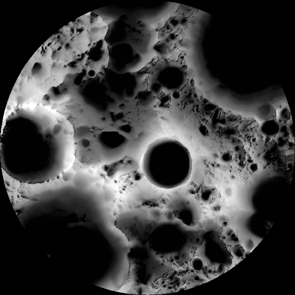
The Lunar Reconnaissance Orbiter Camera (LROC) constructed the “Illumination Map” using over 1700 photographs of the Moon’s south pole over a six month period. Each image was converted to binary by marking illuminated pixels as 1 and shadowed ones as 0. For every pixel this binary data was recorded over six months and averaged. So the more amount of time a region was shadowed, the more dark it is on the grayscale. Black and white mean always shadowed and always illuminated. The deep black circle in the centre of the image is the 19kms in diameter and 4 kms deep Shackleton crater.
The LROC is making daily (which is about 28 Earth days) and yearly illumination maps for both poles in preparation for future lunar missions.
[NewScientist via Gizmodo]


